iTools what?
iTools started as a purely safety app, where in case of extreme emergency it will give you vital information to be alive and well. Is a live earthquakes monitor, thus can save you crucial seconds - especially when sleeping - to act as planned. Coordinates is a system where is totally independent of address, so you can send your coordinates to 911, 112 or any other emergency agency and pinpoint the exact location of you to come and save you. Light tools can shed light exactly where you see fit to, and compass to help you manually navigate.
Over the years, iTools is being used by ambulances, hitchhikers, boat enthusiasts, private airplanes, in car, and many many people who have the need to send a location to someone that does not have an address. Like a park bench, a certain building point, a house within a huge block with one entrance, a shop in a huge parking lot, any place where address is useless. And also save it as a contact.
In a nutshell, iTools have contributed in saving 3 human lives, where in all cases it was difficult for the ambulance to pinpoint the emergency site. People who were at the site used iTools to send the exact location with coordinates to the ambulance.
Really proud for iTools.
Features
suitable for everyone in move!
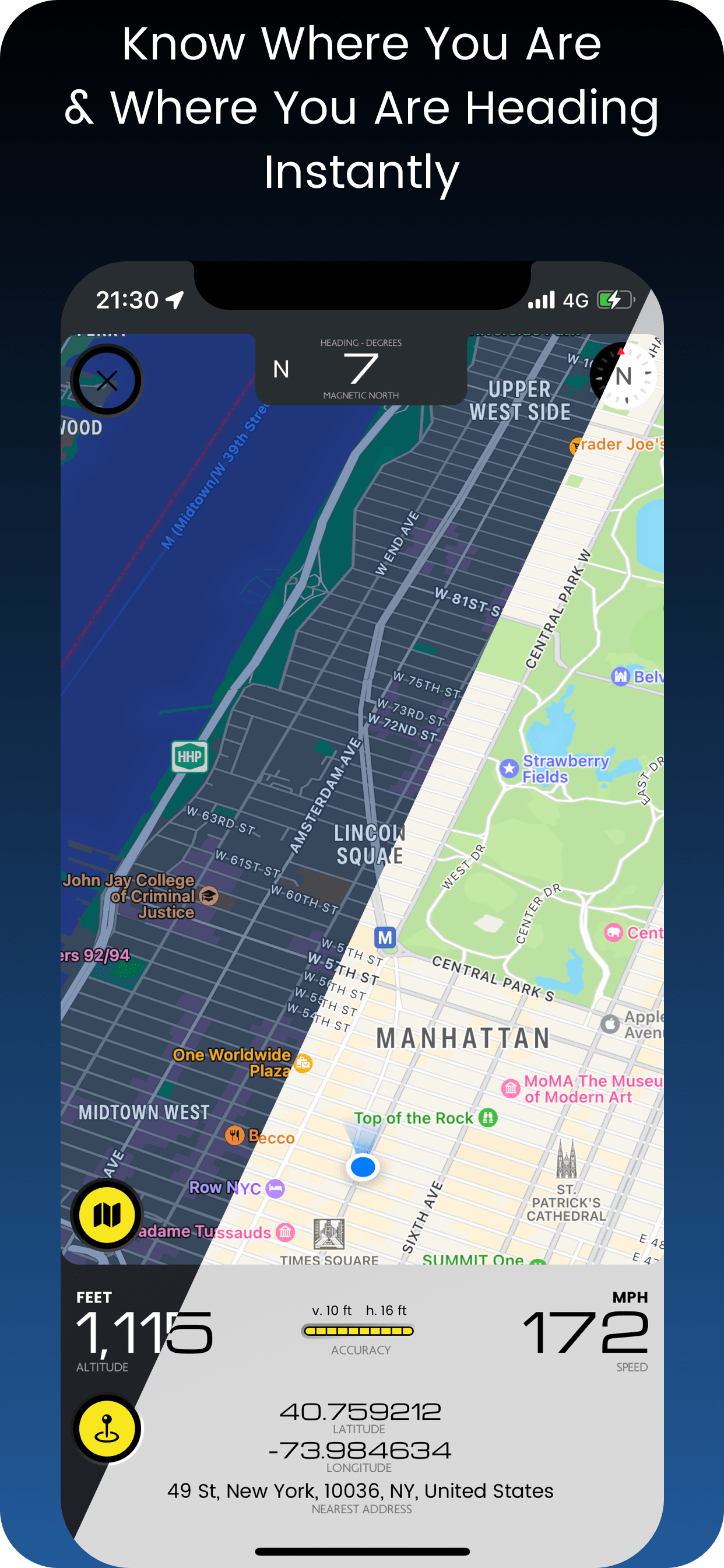
MAP OVERLAY
Along with crucial info, 2D or 3D map with heading. More infoSEISMOMETER
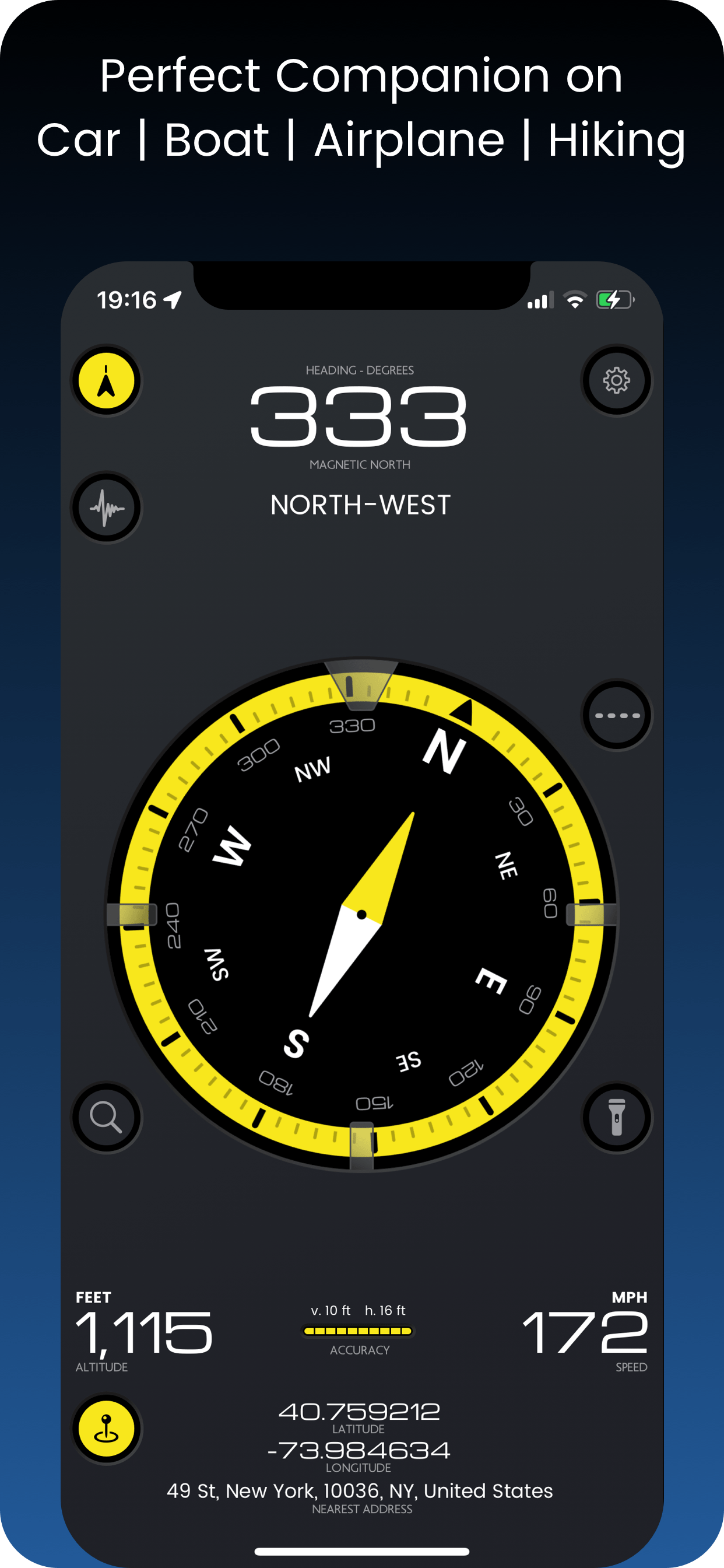
Earthquake live monitor & alarm. More infoCOMPASS
Big Multi-color compass with Heading and Degrees - works with the built-in magnetometer or movement (if magnetometer is not available) - a fail safe feature.SHARE LOCATION
Send your coordinates with address. Message & email. More info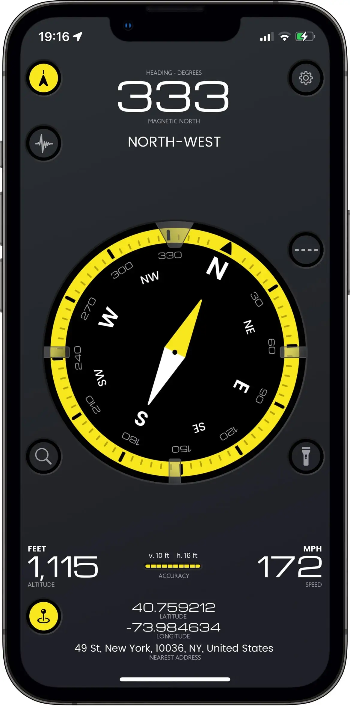 Measurements during a private flight
ALTITUDE - SPEED
Cycle through various units and see your altitude & speed with maximum accuracy. Works best when outdoors.LIGHT TOOLS
Flashlight with camera for tight corners, flashlight & sos flashlight.LOCATION INFO
Current address & coordinates display. Know exactly where you are.LOCATION ACCURACY
Is your location accurate enough for you? See it in a glance.MAP OVERLAY
HEADING
Your heading degrees right in front for your convenience.3D VIEW
Slide two fingers to the top to see the 3D map overlay.SATELLITE VIEW
Toggle between standard map view or satellite view.SHARE LOCATION
Send your coordinates with address. Message & email. More info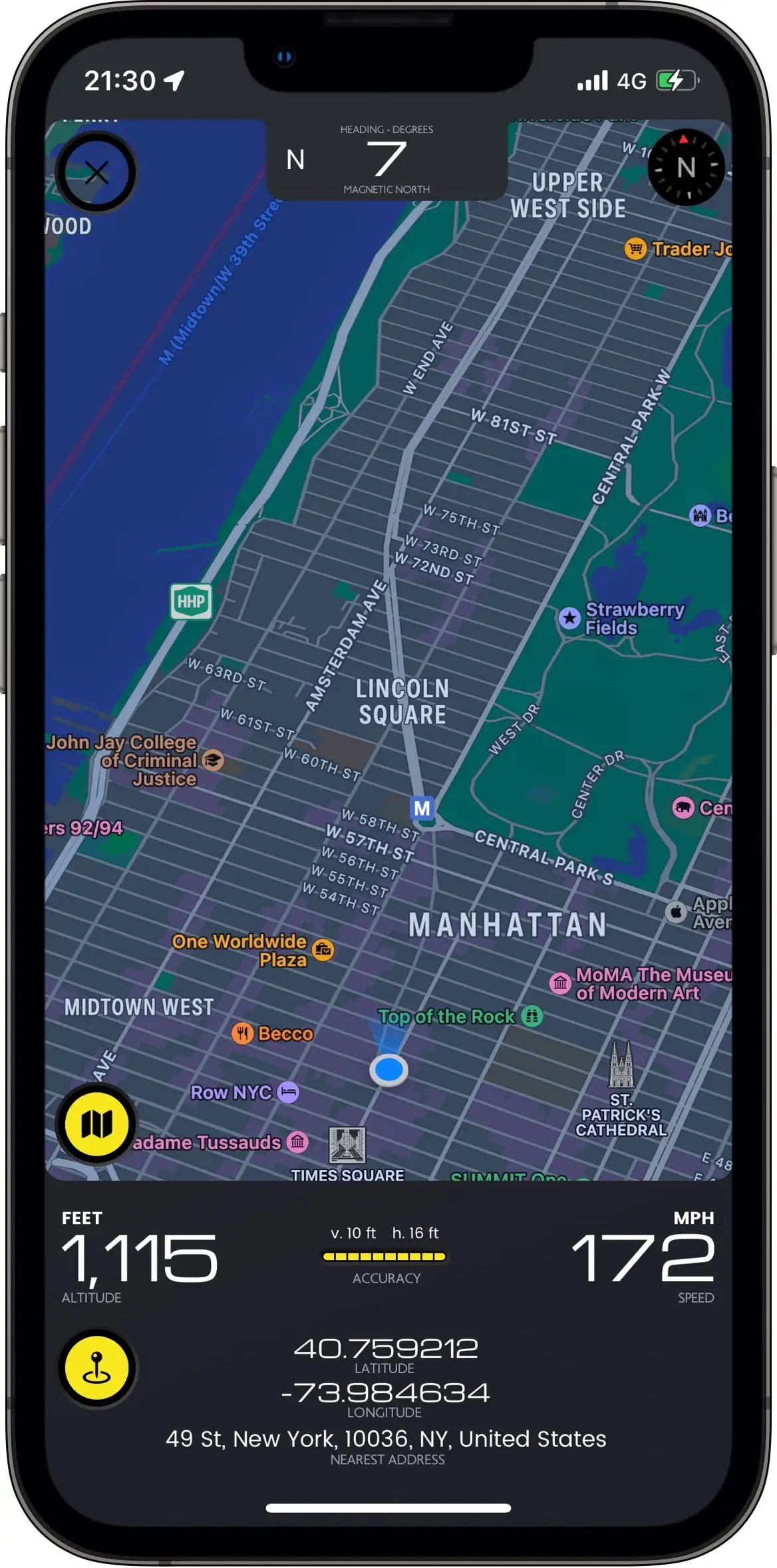 Map overlay during a private flight
ALTITUDE - SPEED
Cycle through various units and see your altitude & speed with maximum accuracy. Works best when outdoors.LOCATION ACCURACY
Is your location accurate enough for you? See it in a glance.LOCATION INFO
Current address & coordinates display. Know exactly where you are.SHARE LOCATION
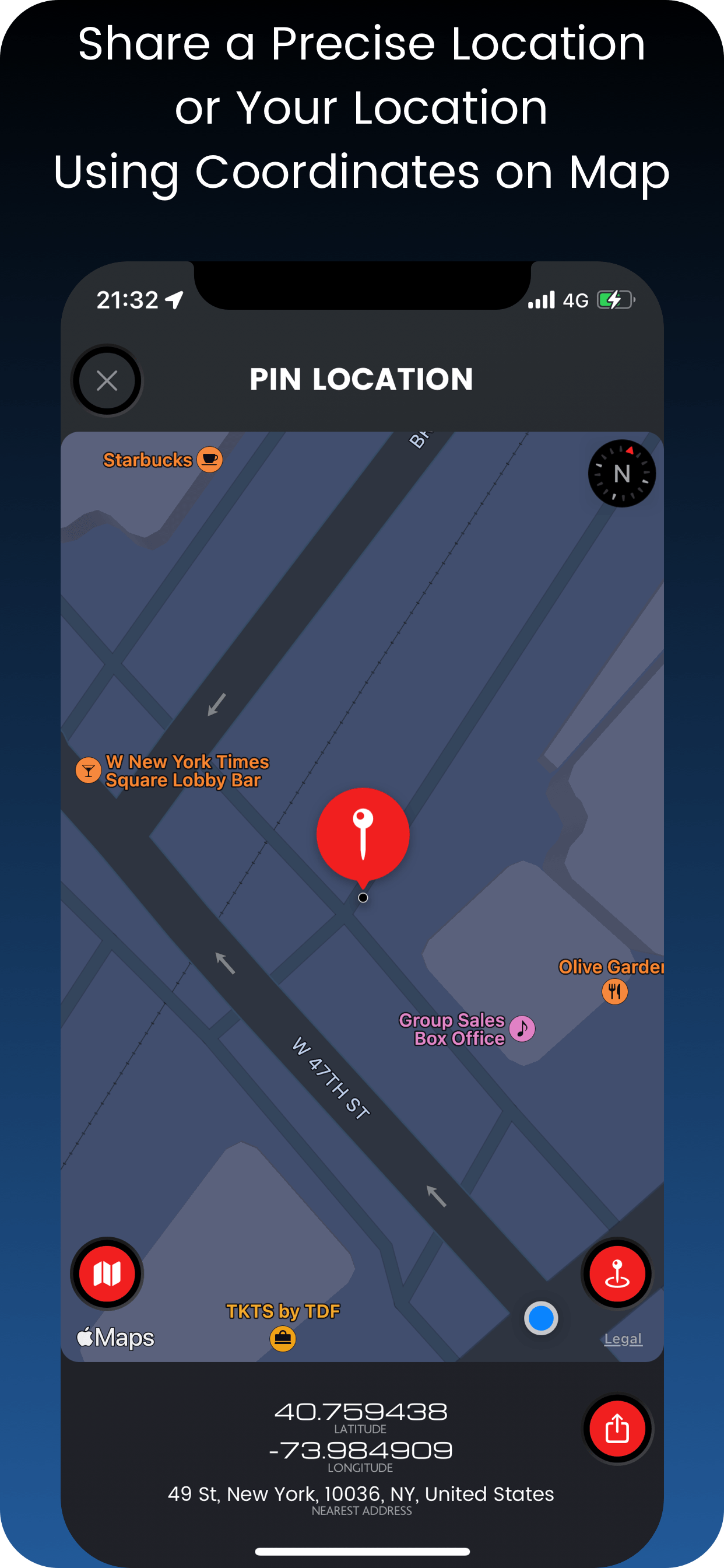
by using coordinates on map.
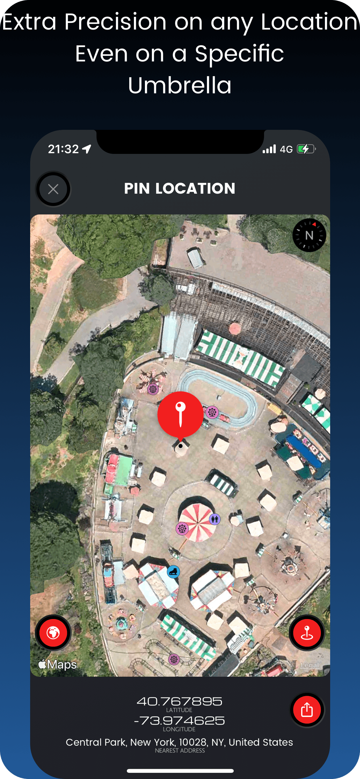
Extra precision means an umbrella on a park or a car park slot!
LOCATION PRECISION
Pinpoint anything on the map or your location by using coordinates.SATELLITE or MAP VIEW
Toggle between standard map view or satellite view.LOCATION or PIN INFO
Current address & coordinates display. Know exactly where you are or your pin is.COMPATIBILITY
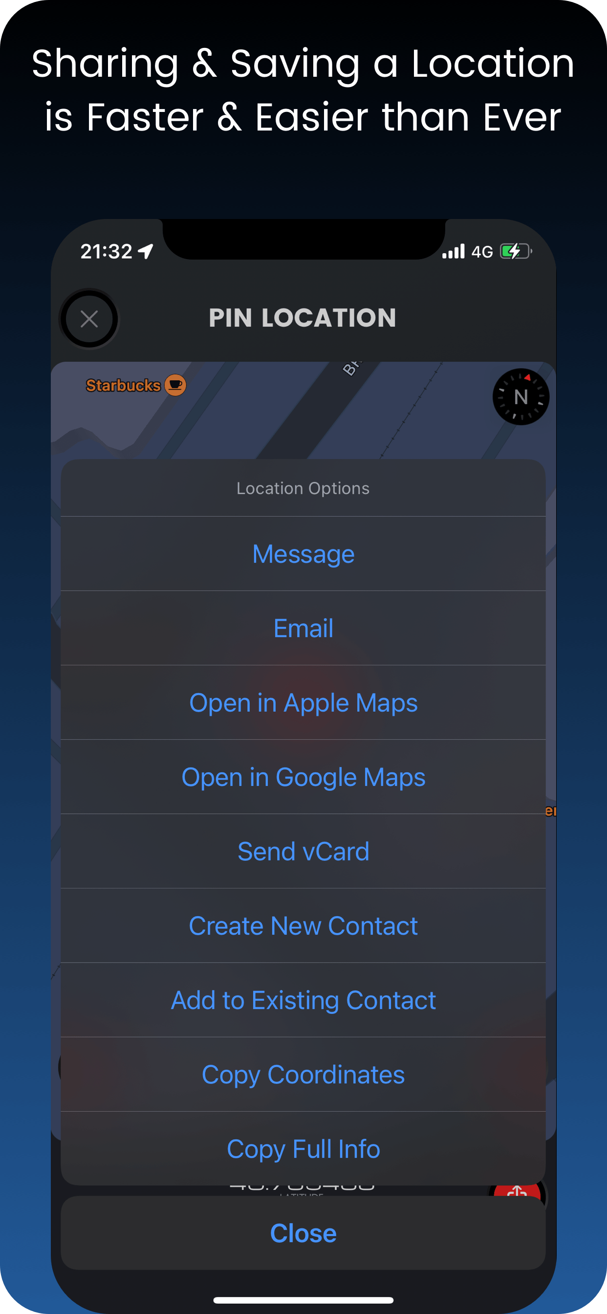
Sending map links can be a pain. Not here. Links are compatible with any smart device.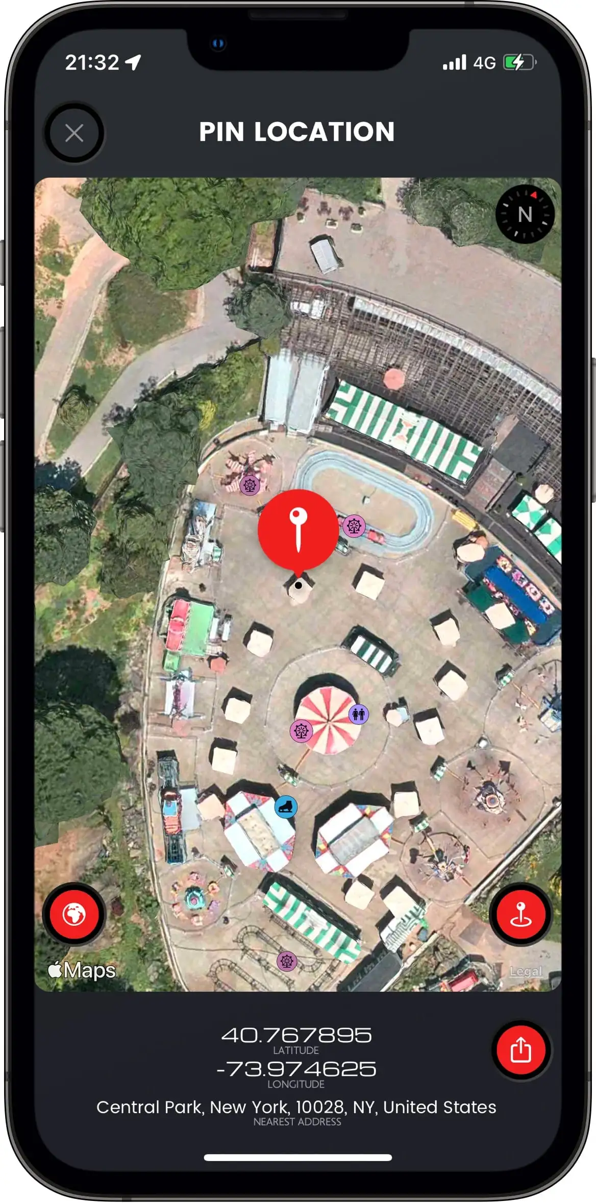 Our meeting point under that umbrella in the heart of New York
MESSAGE LOCATION
Easy iMessage or SMS with all location infoEMAIL LOCATION
Send an email with Coordinates, Address, Map links and Map screenshot.SAVE LOCATION
Save a precise location to an existing contact or a new one. Then you can tell Siri to drive you there.ATTACH vCARD
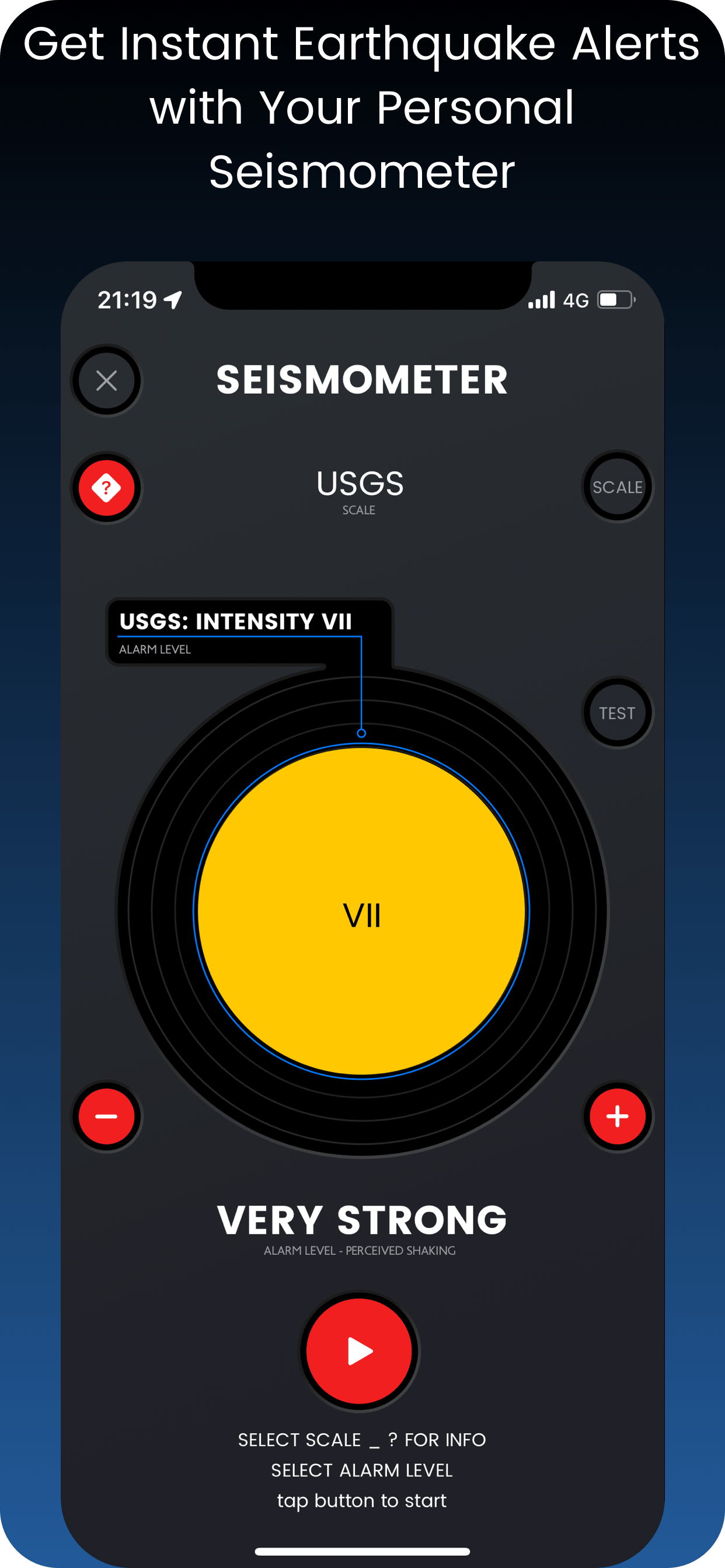
Send a vCard (a contact's file), containing precise location information.Seismometer
PROTECTION
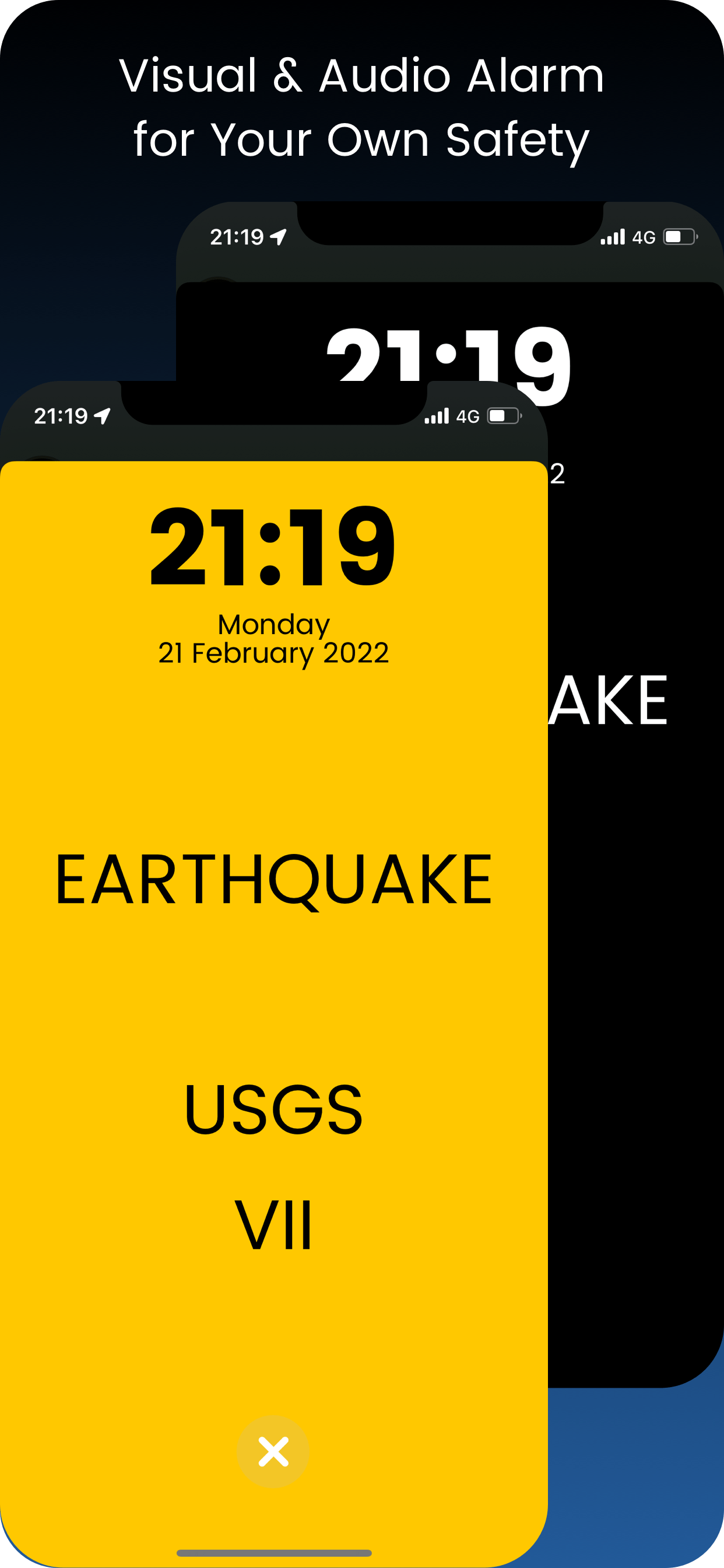
Seismometer will alert you of an earthquake as you can feel it exactly where you are.LIFESAVER
While at sleep? Will wake you up and save crucial seconds of action. A true lifesaver.ALGORITHM
A special designed algorithm senses the motion of the device and converts it into earthquake scales.DESIGN
Continually improving design, to make it easier and handier.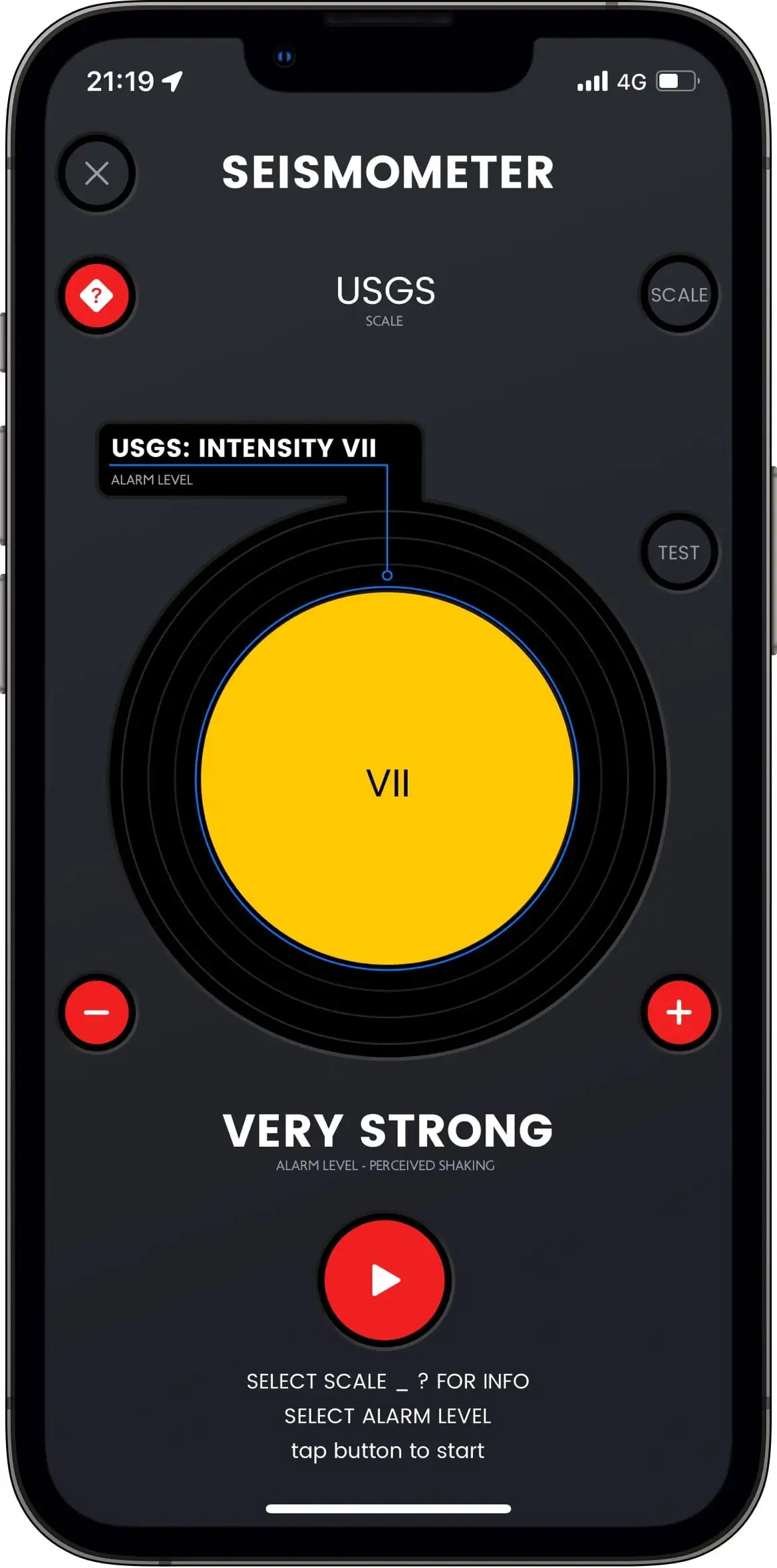 * Used by various academic institutions for demo purposes
EARTHQUAKE SCALES
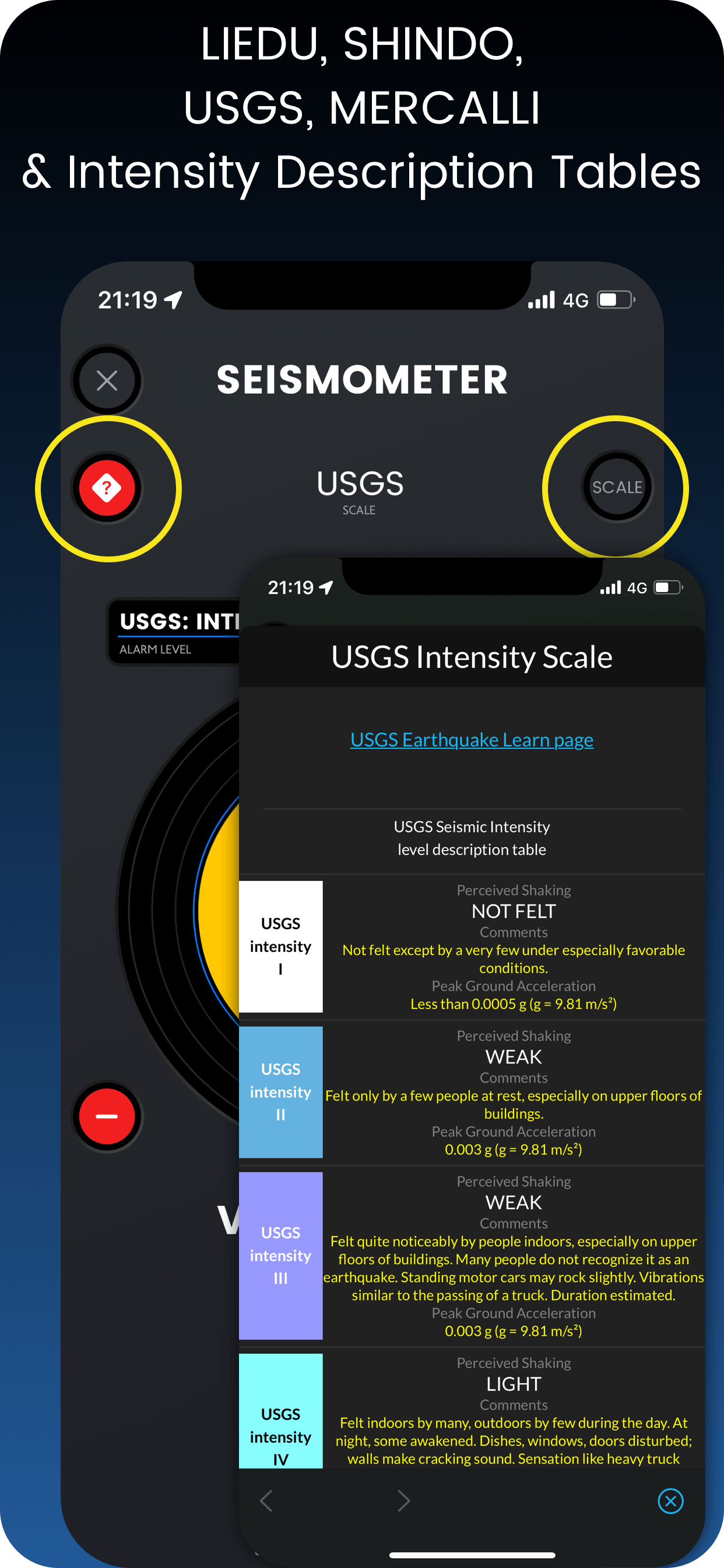
Cycle through the 4 major earthquake scale: USGS (USA), Shindo (Japan), Liedu (China), Mercalli (World).HELP ON SCALES
Every scale has its shaking table. Please advise it before choosing an intensity level.INTENSITY LEVELS
Set the level of perceived shaking (alarm) every scale has to offer.ALARM
Instant alarm with audio & visual feedback. Press TEST button to see what happens.ScreenShots
Settings
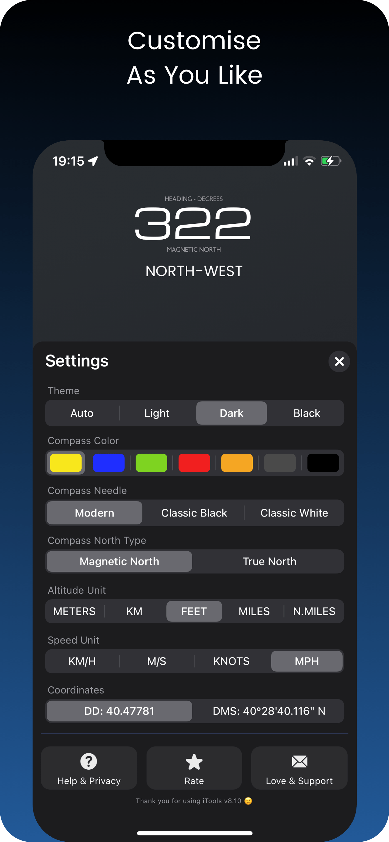
COLORS
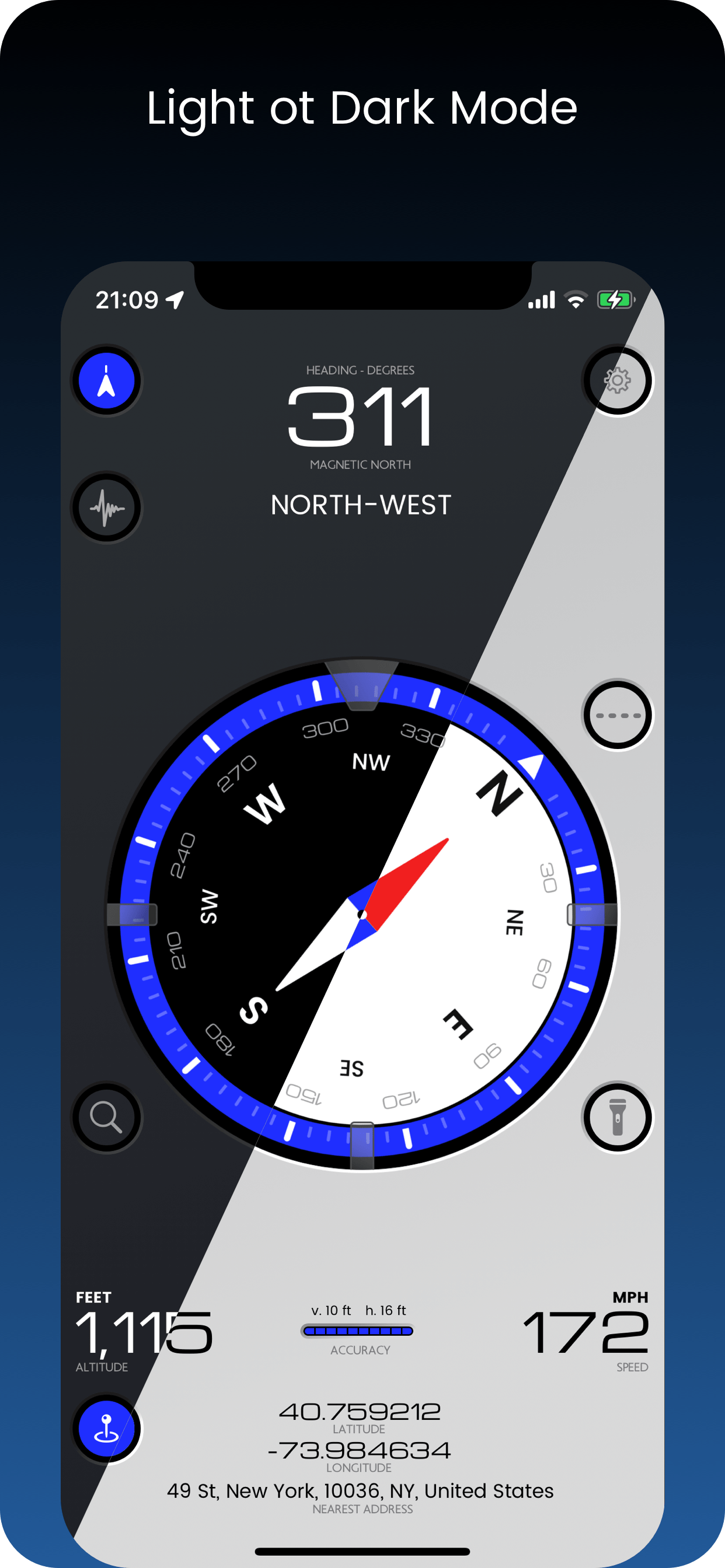
Personalization starts with color. Choose one to start with.DARK OR LIGHT?
Can be both ways to make it more comfortable under various light conditions.COORDINATES
Choose what suits you best. DD or DMS. More to come in future updates.ALTITUDE UNITS
Meters, Kilometers, Feet, Miles, Nautical Miles. All are here.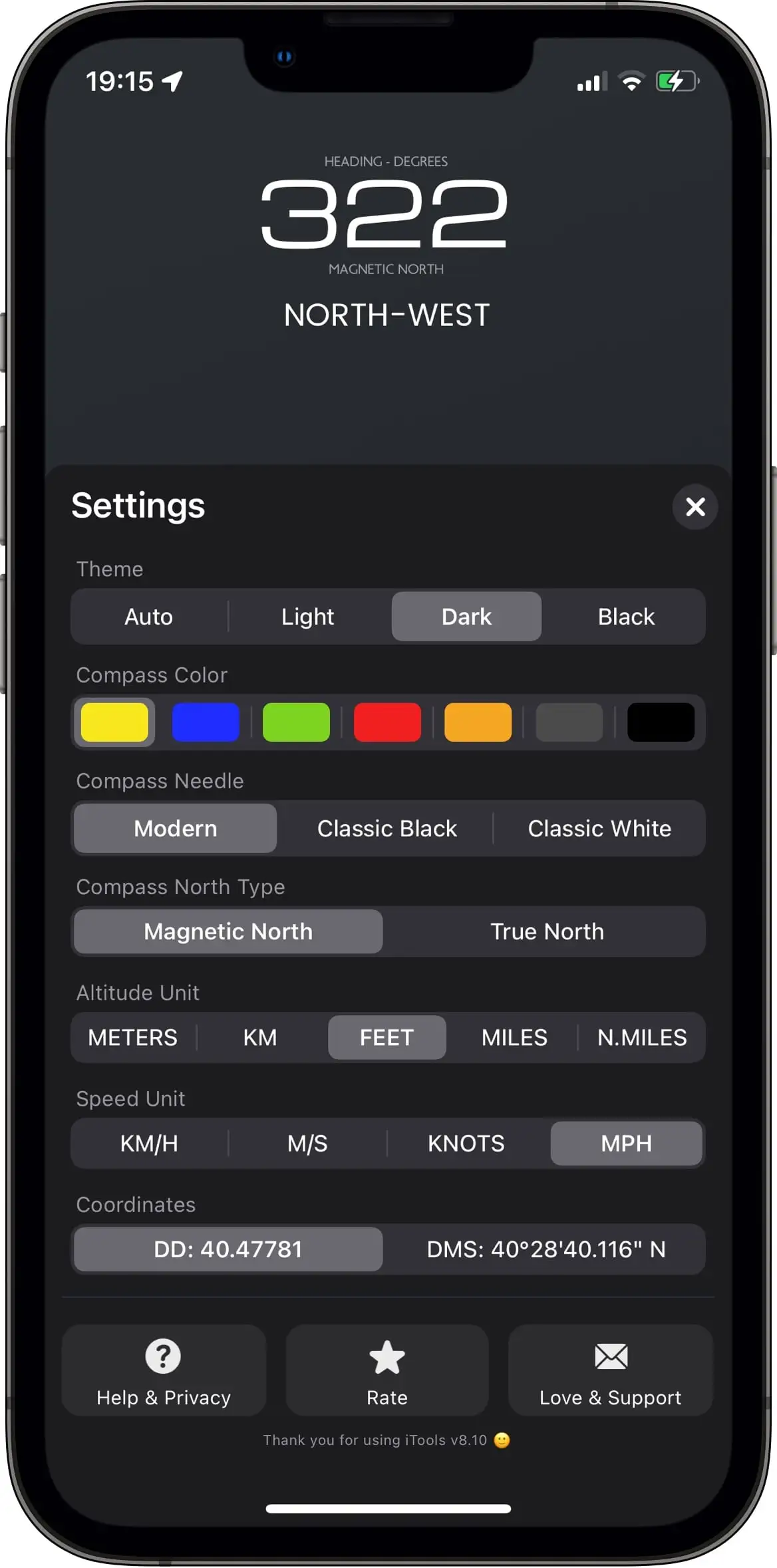 * Thank You for Using iTools 😀
SPEED UNITS
Choose what suits you best.NORTH TYPE
Magnetic or True? You know, magnetic north is changing.HELP
Here you can find anything about iTools.SUPPORT
If FAQ is not enough, we got you covered. Send in your message directly to Support and soon you will get a response.FAQ
If you still have a question contact us via iTools' Settings.
- It gives you detailed and important location information,
- Can share an exact location everywhere by using coordinates,
- Can alarm and save crucial seconds when an earthquake occurs - especially during sleeping
- iTools gives you all the navigation information you need in a beautiful and intuitive way,
- iTools has optimized code to consume as little battery as possible,
- iTools gives you Seismometer, a super safety tool if you are afraid earthquakes
- Press bottom left button with Pin to show Share Location view.
- Press bottom right button to show you sending options.
A special algorithm translates movement into the 4 widely used earthquake scales.
- Select Scale
- Press "?" button to read about the specific scale and its levels of intensity
- Press "Test" to see and hear the alarm
- Adjust your desired alarm level of intensity by using "+" & "-" buttons
- It is recommended - but not obligatory - to enable airplane mode and disable wifi and bluetooth
- Leave device on a steady surface like the floor
- Press Play button to start
- USGS: USA (more info)
- Shindo: Japan (more info)
- Liedu: China (more info)
- Mercalli: World (more info)
Intensity movement scales are human oriented and easier to understand and use.
iPhones & iPads are the safest devices you can use, but there are rare cases where some equipment always connected to chargers malfunctioned. Especially iPads can be used as kiosks - meaning always connected to power. In any case use your equipment at your own risk as iTools app can not be responsible for any battery or device malfunction.
Download now
iTools app will make your life easier.